Field principle
A compass is a direction tool, not a position finder. Combine it with a map, terrain, distance and checkpoints to avoid confidently walking the wrong route.
On this page
Identify the compass parts
- Baseplate: Clear edge and direction-of-travel arrow align a map route with the compass.
- Rotating bezel: Degree ring for reading and setting a bearing, usually 0–360 degrees clockwise.
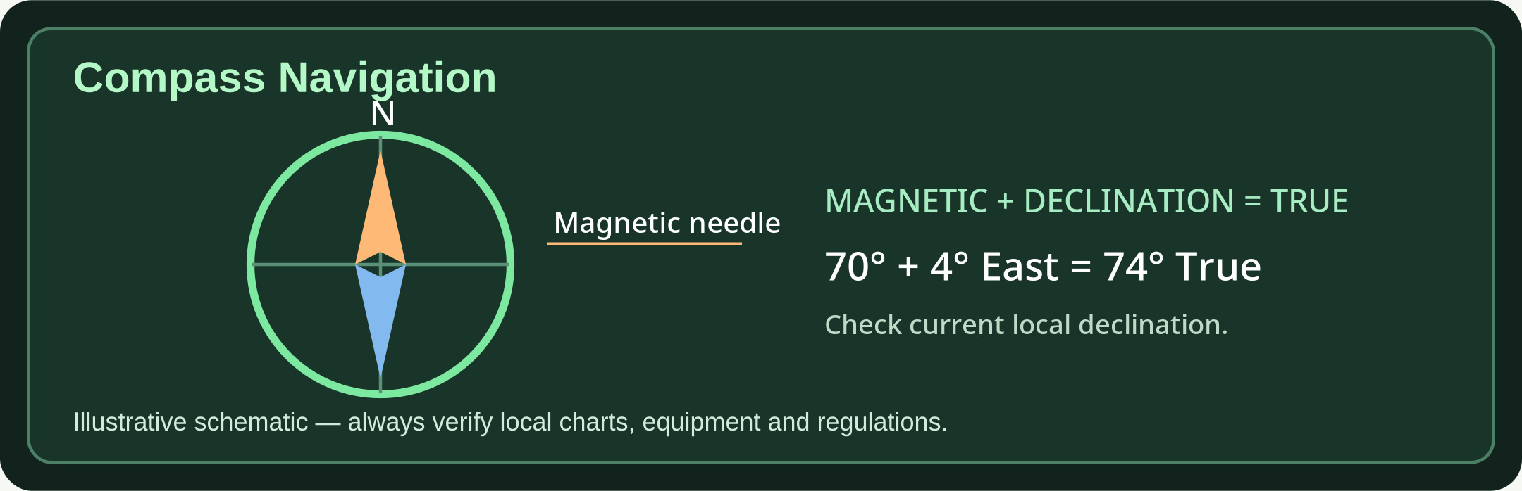
- Magnetic needle: The north-seeking end points toward magnetic north when the compass is level and clear of interference.
- Orienting lines: Parallel lines inside the bezel that align with map grid north lines.
Take a bearing to a landmark
- 1. Aim: Hold the compass level, direction-of-travel arrow aimed at a distant distinct landmark.
- 2. Set: Rotate the bezel until its orienting arrow aligns under the north-seeking needle.
- 3. Read: Read degrees at the direction-of-travel index, not at the needle tip.
- 4. Travel: Choose a close intermediate landmark along that bearing and walk to it; repeat the check.
Convert magnetic and true bearings
- Know the datum: True north, magnetic north and map grid north differ. Read the map legend and its north arrows.
- Use the current declination: When east is positive and west negative: TRUE bearing = MAGNETIC bearing + declination; normalize 0–359 degrees.
- Example: A 70° magnetic bearing at +4° east declination becomes approximately 74° true. A 70° magnetic bearing at −4° west becomes 66° true.
- Reverse: Magnetic bearing = true bearing − declination. Do not correct twice when using an already-adjusted declination compass.
- Check location/date: Declination varies with location and time; older printed map values can be wrong.
Orient a map and measure direction
- Find the north reference: Read map north, grid north, scale and contour interval; use matching north references consistently.
- Align the map: Place compass on the map, adjust for declination, and rotate map and compass until the needle aligns with the orienting arrow.
- Set a course: Join your current known point to a destination; place baseplate edge along the course and rotate bezel until its north lines parallel the map grid.
- Cross-check: Compare expected terrain features, path junctions and crossings. Do not follow a bearing blindly across hazards.
Avoid common errors
- Metal and electronics: Move away from vehicles, steel structures, magnets, phones and electrical equipment while taking a reading.
- Reverse-bearing confusion: A back bearing is 180° opposite the forward bearing (add or subtract 180°). Check before retracing.
- Lost position: Stop, shelter if necessary, identify last known location, retrace only when safe, and use emergency communications if in danger.
- Practice first: Test on a known route in daylight, using more than one visible checkpoint.
Further reading & source material
Use these sources to validate local rules, technical standards and updates. No emergency article replaces official alerts or trained responders.